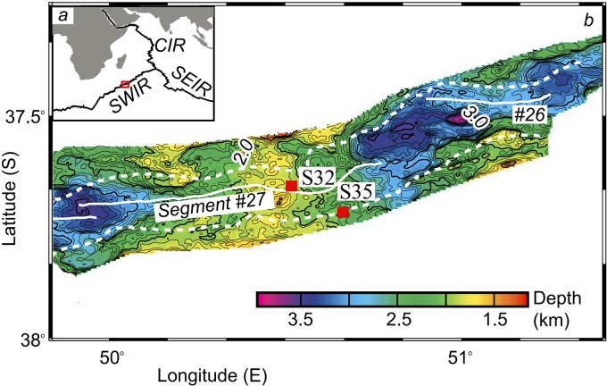
FIG 1 .
Map of the sampling sites on the Southwest Indian Ridge (SWIR) (modified from Zhu et al. [15] with permission). (a) Location of the SWIR, close to the Central Indian Ridge (CIR) and the Southeast Indian Ridge (SEIR). (b) Magnified view of the bathymetric map of the location indicated by the red box in panel a.

