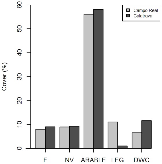
Figure 1. Land use cover in the study sites.

Cover percentage of the land uses considered for Maxent modelling in 2011 in Campo Real and 2008 in Calatrava (F: short term fallows, NV: natural vegetation encompassing long term fallows and low height scrubs; Arable: cereal fields and ploughed lands; LEG: leguminous crops; DWC: dry woody cultures).
