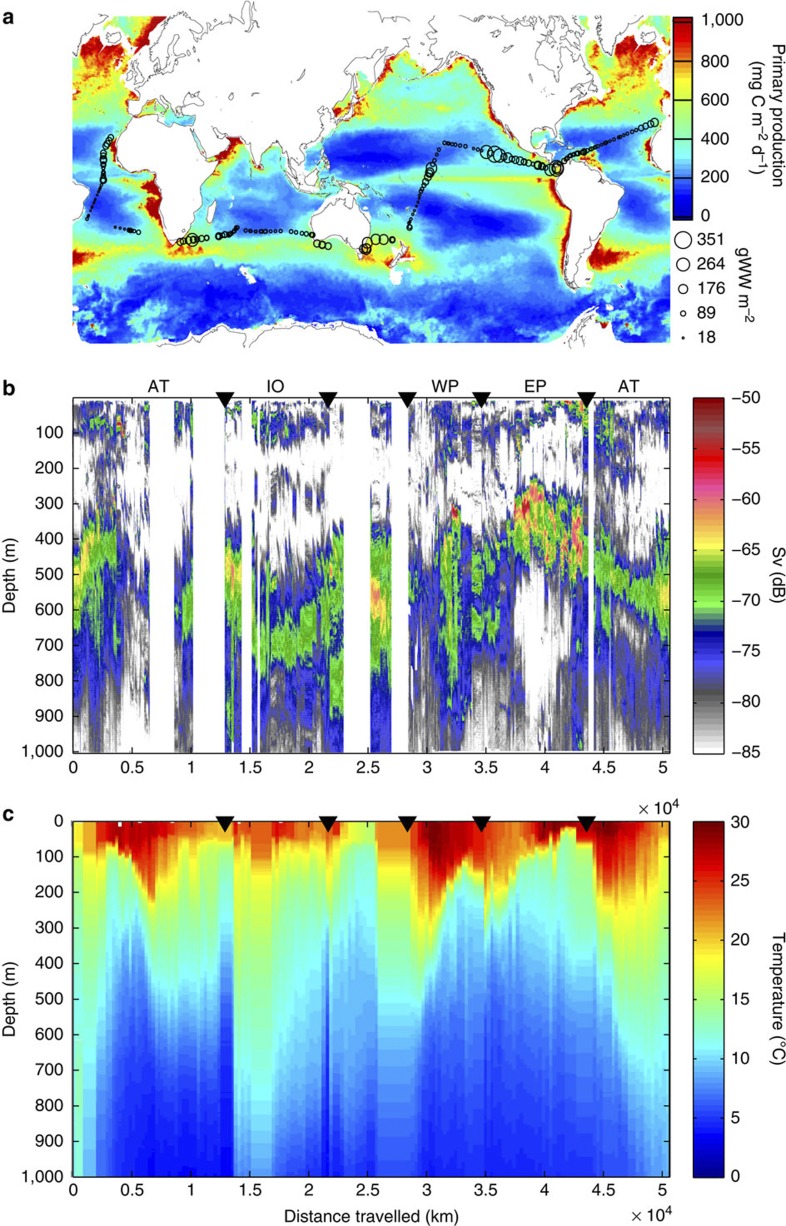
Figure 1. The Malaspina cruise.
(a) The surface-integrated estimated mesopelagic fishes biomass (g wet weight per m2) for the 200–1,000 m depth range along the Malaspina 2010 Expedition cruise transect (black circles) superimposed on a satellite-derived global map of PP (average in mg C m−2 d−1 for 2010–colour bar); (b) a daytime echogram from 0–1,000 m along the cruise track (measured in dB—colour bar), and (c) interpolated temperature profiles along the cruise track (measured in °C—colour bar). The black triangles in b and c indicate the border between oceanic basins. AT for Atlantic Ocean, IO for Indian Ocean, WP for Western Pacific and EP for Eastern Pacific.

