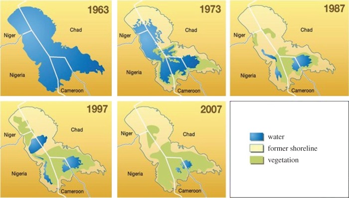
Figure 2.
Lake Chad water levels from 1963 to 2007. This collection of maps has been sourced from a series of satellite images provided by NASA Goddard Space Flight Center (http://maps.grida.no/go/graphic/lake-chad-almost-gone; image credit: Philippe Rekacewicz). (Online version in colour.)

