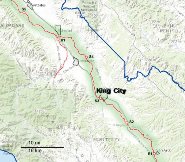
Figure 2.

Map of the Southern part of the sampling area, consisting primarily of the upper Salinas River (S1 through S5). The waterways are marked as red lines, and the sampling sites are indicated along the red lines. The sampling sites are labeled with a letter corresponding to the watershed to which they have been assigned and a number to differentiate between sites within that watershed. X indicates sites that were sampled regularly but do not fit into any of the designated watersheds.
