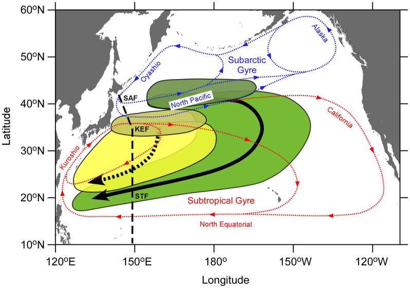
Figure 5. A schematic view of formation and subduction of mode waters in the North Pacific.
Yellow and yellow-shaded ellipses indicate spreading and formation areas, respectively, of STMW (25.0–25.6 σθ). Green and green-shaded areas indicate spreading and formation areas, respectively, of CMW (26.0–26.6 σθ), which is denser than STMW. Thick broken and solid arrows show spreading directions of STMW and CMW, respectively. Blue and red dotted lines are surface water currents of the subarctic and subtropical gyres, respectively. The broken line denotes our observational line at 149°E in the winter of 2012. SAF, KEF, and STF indicate the subarctic, Kuroshio Extension, and subtropical fronts along the observational line, respectively. The map in this figure were drawn using Ocean Data View54 and this figure has been modified from one in the literature55.

