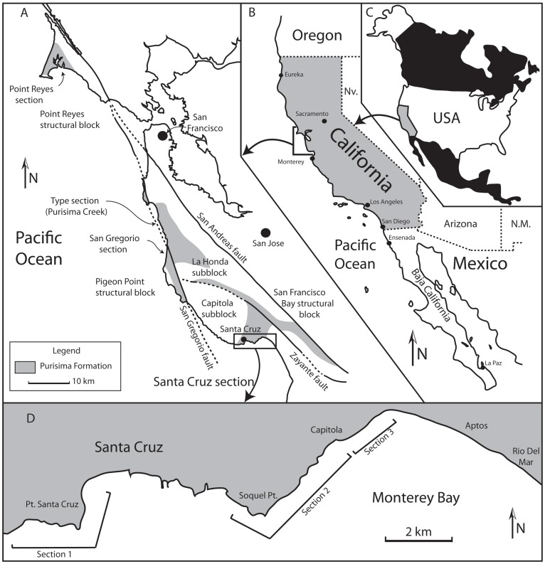
Figure 1. Geologic map of the Purisima Formation.
(A) Generalized geologic map of Purisima Formation exposures in Northern California, modified from Boessenecker (2011). (B) Geographic location of (A) in California, and (C) map of North America showing location of (B). (D) Map of Santa Cruz county coastline showing location of cliff exposures and sections 1, 2, and 3 examined during this study. Abbreviations: ss, sandstone; sls, siltstone; ms, mudstone.

