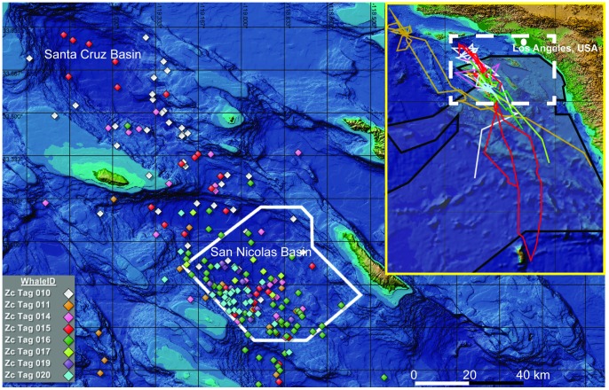
Figure 1. Map of the study area displaying one daily position estimate of each tagged whale.
All eight whales were tagged within the Southern California Anti-submarine Warfare Range (outlined in solid white). Tagged whales were within the San Nicolas Basin for 51% of all days tags transmitted, and within the SOAR boundaries for 71% of the days when in the basin, suggesting site fidelity to the MFA sonar training range. Inset map shows the entire track-line of each tagged whale with the primary map region indicated by a dashed box. The SOCAL Range Complex, which encompasses all areas of authorized MFA sonar use [6], is lightly shaded and outlined in black in the inset map. Map created using Mysticetus Observation System, v1.8.0.124 (Entiat River Technologies, Preston, WA, USA).

