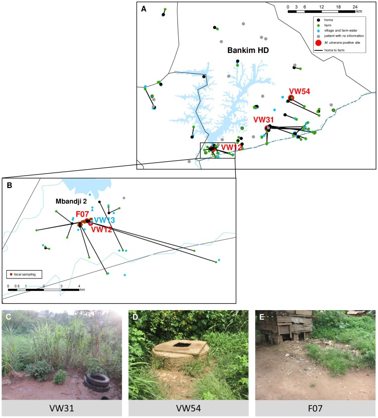
Figure 1. Environmental contact network of laboratory confirmed BU patients from the southern Mapé Basin.
Panel A and B (detailed view of the village of Mbandji 2) show the houses where the 46 laboratory confirmed BU patients in our study lived (black points), the farm(s) where they worked (green points) and the locations where they obtained their water (blue points) during the year before the onset of BU symptoms. The home of each patient is connected with their farm(s) as applicable. Homes of 17 of the 21 non-participating laboratory confirmed BU patients were also mapped and are shown in grey. At the farms and water contact locations, soil (n = 171), plant (n = 153) and water (n = 109) samples were collected. Furthermore, in Mbandji 2 (B), animal faecal samples were collected around patients' houses (brown points). All samples were tested for the presence of M. ulcerans DNA and three village water locations were found to be positive (red points; VW12, VW31 and VW54). Further, at location F07 a positive duck faecal sample (red point) was collected. Photographs of locations VW31, VW54 and F07 are shown in C, D and E, respectively. Finally, Panel B also shows a negative water contact location (VW13) which was studied in detail.

