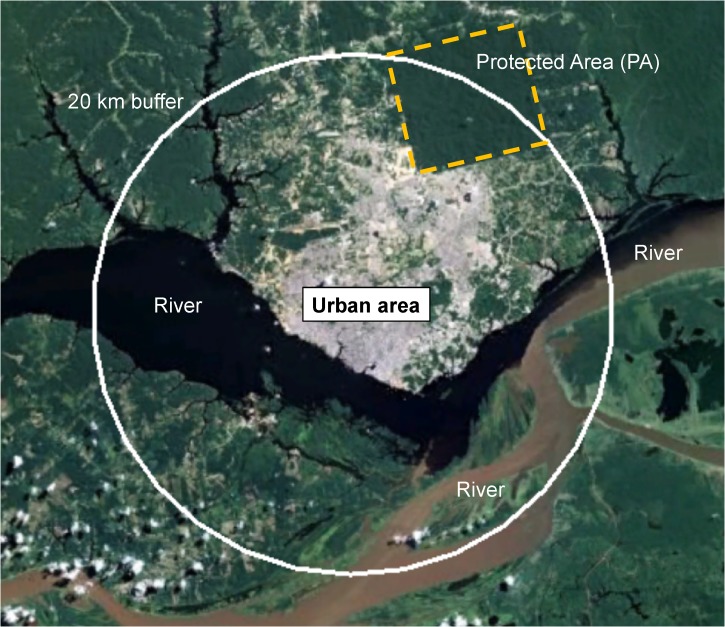
Figure 2.
Map of Manaus with a 20-km buffer. This map uses Manaus, the largest city in the Amazon, as an example of one of the study areas in the work by Valle and Clark1 to show the potential issues with their analytical approach. The 20-km buffer that they used in their analysis covers almost the entire urban area (grey) and some of the rural area. The city has a large forest reserve (PA limits shown with a yellow dotted line), which is within the 20-km buffer. According to the analysis by Valle and Clark,1 they would likely find a high number of malaria cases associated with high forest cover because of the forest reserve. However, the malaria cases that would be reported to the health department in Manaus would not originate in the city or the forest reserve (which is not inhabited). The cases would occur in the rural populations along the rivers and creeks outside the 20-km buffer.

