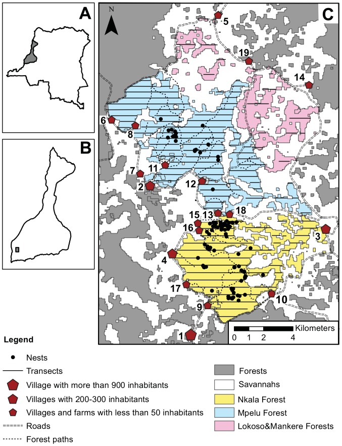
Figure 1. Map of the study site (16.41–16.56°E, 2.45–2.66°S, West DRC).
A. Location of the Lake Tumba landscape in Democratic Republic of Congo. B. Location of the study site inside Lake Tumba landscape. C. Map of the study site. Forests are indicated in grey and savannahs in white (the map is based on a non-supervised classification – RED and IR on a Landsat7 (2007)). To represent the further subdivisions we made of the area, we coloured in yellow and blue the two suspected home ranges of bonobo communities habituated by WWF-DRC. Pink indicates the forest patches of re-colonizing Uapaca sp. Villages are depicted as red pentagons. Number 19 represents the WWF-base. Parallel dashed lines indicate the roads surrounding the study site, whereas dotted lines indicate the main forest paths. Vertical solid lines depict the 114 line transects (179.1 km) travelled in 2011, 2012 and 2013, and the nesting sites visited for our nesting site study are depicted as filled-in black points.

