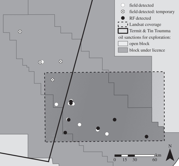
Figure 3.
Ground-validated versus Random Forest model-detected oil exploration sites for the Niger study area. Geo-referenced field data from SCF are depicted, representing both temporary (circles with black crosses) and ‘permanent’ sites (white circles) visited between 2009 and 2011, within the study area (dashed black rectangle). Black circles depict the model-detected sites from the Landsat 7 ETM+ scene. Model-detected sites were confirmed by inspection of the RGB visualization (7, 4 and 2 bands) of the Landsat 7 ETM+ scene. A total of seven sites were detected by the Random Forest model; four sites matched the geo-referenced field data and three new sites were found. Three of the seven ground-validated ‘permanent’ sites within the study area were not detected by the identification framework. The TTTNNR is the area to the left of the thick black line, and six ground-truthed observations of oil exploration activity can be found within the PA borders. Dark grey blocks denote oil concessions that are currently under licence (purchased), while light grey blocks indicate open (unpurchased) blocks.

