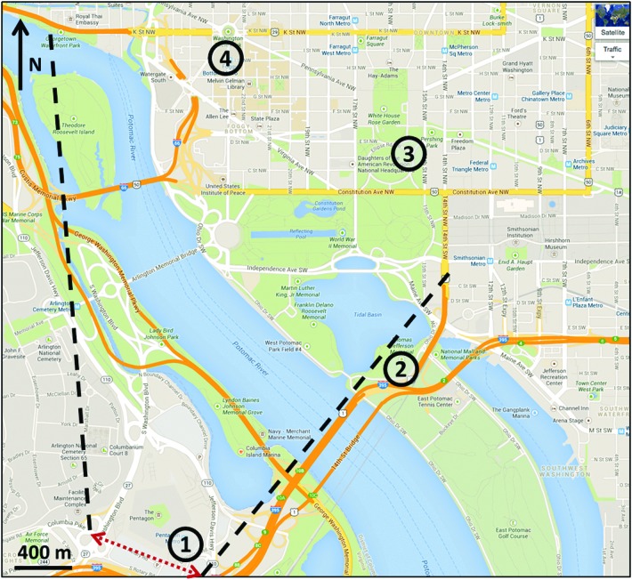
Figure 2.
Predicted downwind dispersion areas and sample collection locations for 2009 release. The approximate release location is shown by the red dotted line. The black dashed lines show the boundaries of the predicted downwind dispersion area. The high-volume air sampler locations are shown as circles; environmental samples were collected in the immediate vicinity of the air samplers.

