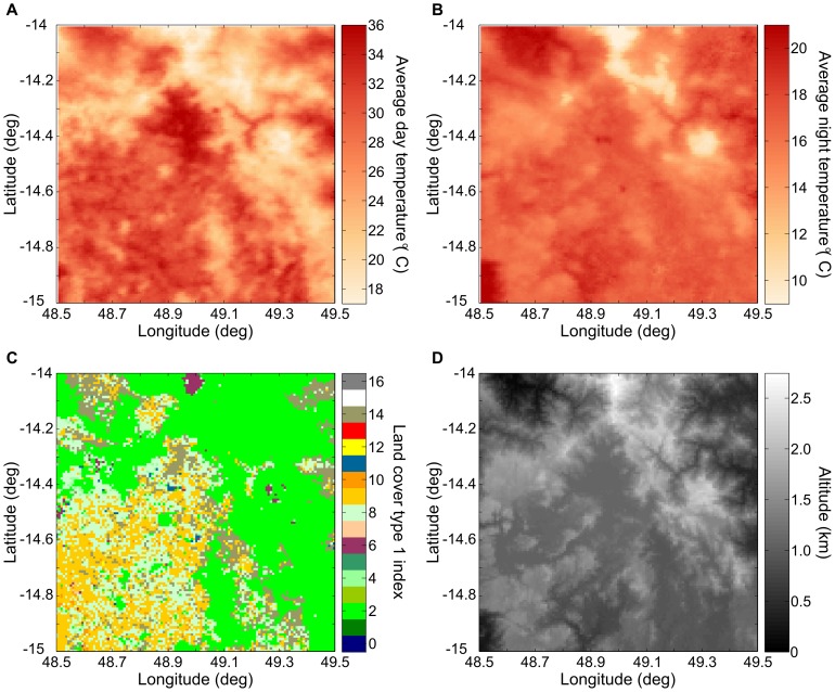
Figure 13. Daytime and nighttime land surface temperature.
(A–B) Average land surface temperature in a region of Madagascar for January 1st during the day (at approximately 2 pm) and at night (approximately 2 am) from MODIS aboard the AQUA satellite. (C) Land cover type 1 index classification from the MODIS 12 product [78]. The dominant land cover classification in this region are evergreen broadleaf forest (index 2), savannas (index 9), woody savannas (index 8), barren or sparsely vegetated (index 16), and closed shrubland (index 6). (D) Altitude of the region from the WorldClim data set [64]. Daytime land surface temperature correlates with land cover type; nighttime land surface temperature correlates with altitude.

