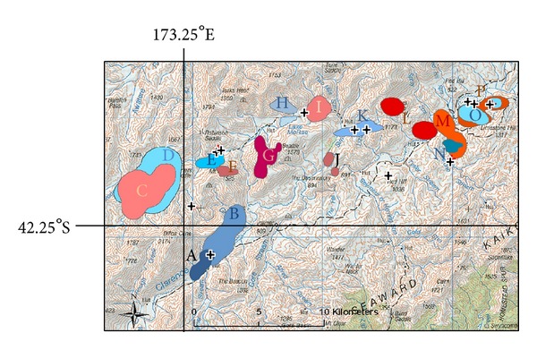
Figure 3.

Fine detailed topographic map depicting location, shape, and size of the 95% kernel home ranges calculated from GPS units recovered from 16 purpose-reared sentinel pigs, released onto Molesworth Station and Clarence Reserve. Each individual pig's home range is depicted by a different colour and letter (n = 16). In relation to the areas covered by the GPS-tracked released sentinels, overlaid crosses represent kill locations for 12 confirmed TB-positive pigs (both released sentinels and resident wild pigs) shot during hunting forays.
