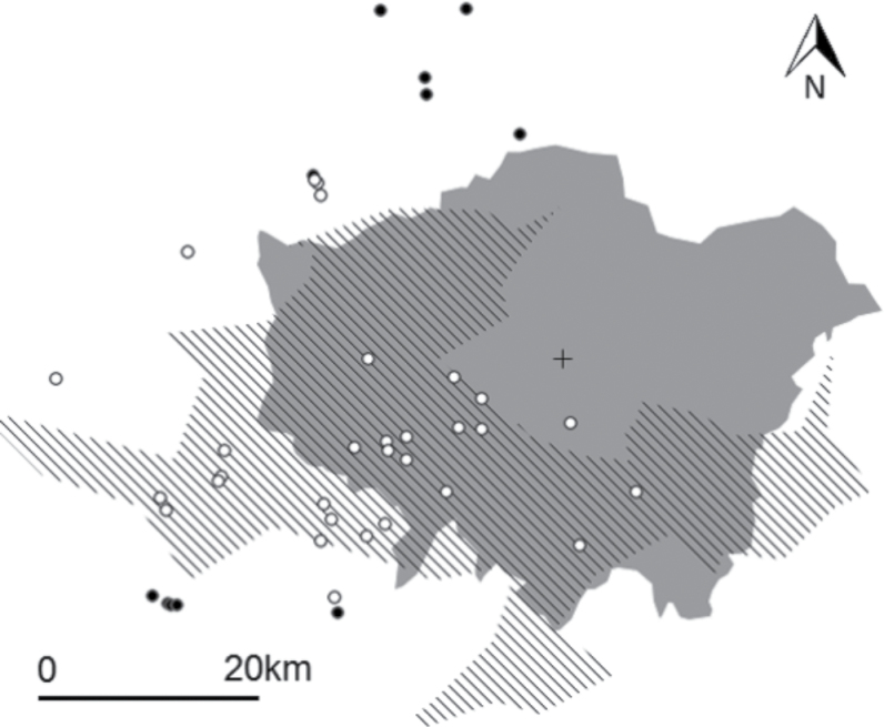
Figure 1.
Experimental feeding site locations across London. Black circles represent parakeet free sites, white circles represent sites where parakeets were present, the solid gray area represents the area of Greater London, the lined polygon represents the area of the 2009 parakeet range (this is the extent of the Breeding Bird Survey 1 km2 squares where parakeets were recorded present in 2009). The cross represents the location of St. Paul’s Cathedral (sites were chosen within a 50-km radius of this).

