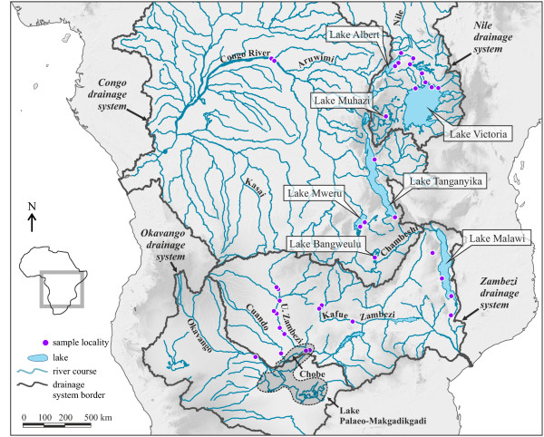
Figure 1.
Map of tropical Africa with major drainage systems. The map shows the major drainage systems, framed with bold grey lines, and the sampling points of the study. Lakes and rivers referred to in the text are labelled accordingly; the Upper Zambezi is abbreviated as ‘U. Zambezi’. The dashed outline indicates the maximum expansion of Lake Palaeo-Makgadikgadi, modified after Riedel et al. [4]. Locality details for each sampling point are given in Table 1.

