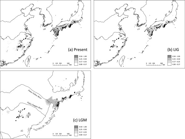
Figure 6.
Modelled climatically suitable areas of Platycrater arguta in East Asia at different times. (a) the present; (b) the Last Interglacial (LIG/Eemian: c. 130,000–114,000 yr BP); and (c) the Last Glacial Maximum (LGM: c. 21,000–18,000 yr BP). The current ecological niche model was established with six bioclimatic data layers on the basis of 59 sites of presence records of the species (black dots) using MAXENT 3.2.1 [76] and then projected onto a set of climatic variables simulated by MIROC 3.2 [80] to infer the extent of suitable habitats during the LGM and the LIG (see text). The map in (c) reflects changes in coastline and shelf exposition during the LGM due to lowered sea level (−110 m than at present; e.g., [7]). Yellow River and Yangtze Rive plaeo-channels in the exposed East China Sea basin are modified after [86]. The logistic value of habitat suitability is shown according to the grey-scale bars.

