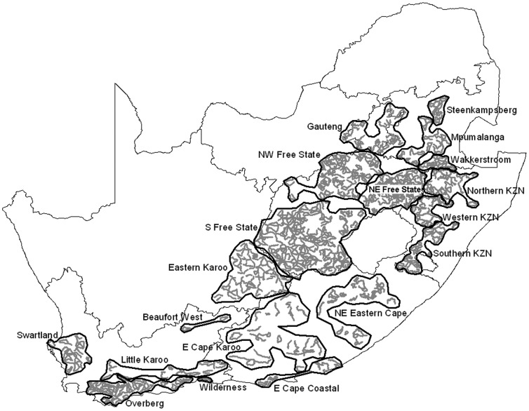
Figure 2. Coordinated Avifaunal Roadcounts (CAR) project survey routes and precincts.
Routes are indicated by thick grey lines, and precincts are outlined in black. CAR routes covered c. 19 000“KZN”, KwaZulu-Natal. Precincts were defined on the basis of ecological characteristics by Young et al. [13] (within precincts the natural vegetation type and climatic conditions are more similar than between precincts) and precinct names follow Young et al. [13].

