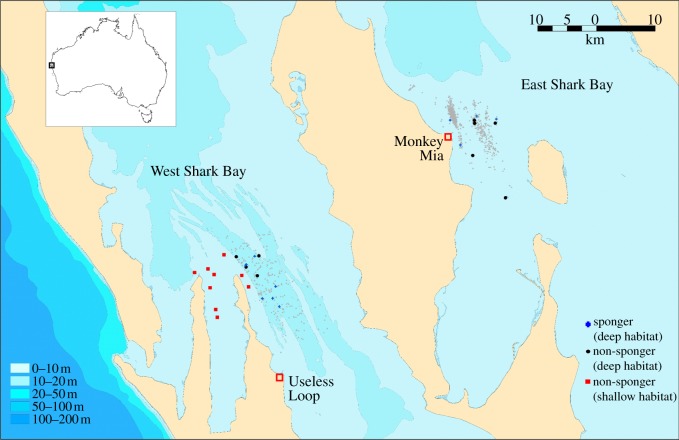
Figure 1.
Map of Shark Bay. Symbols identify sampling locations for spongers/deep habitat (blue crosses), non-spongers/deep habitat (black circles), and non-spongers/shallow habitat (red squares); grey triangles identify locations where sponging has been observed (ESB: 1990–2006; WSB: 2007–2010). Different shades of blue indicate approximate depth.

