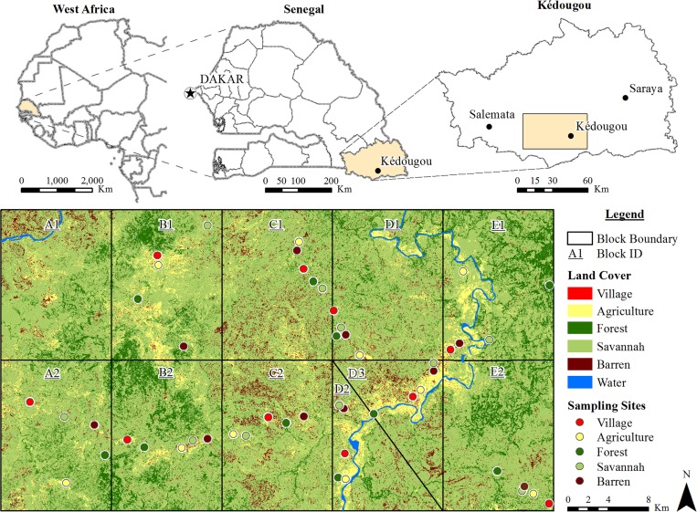
Figure 1.
Study area. The rectangle in the upper right map corresponds to 1,650 km2 divided in the 10 blocks (A2, B1, B2, C1, C2, D1, D2, D3, E1, and E2) below. Data were collected in each of the five land cover classes indicated by colored circles (agriculture, barren, village [indoor and outdoor], savannah, and forest [canopy and ground]) in the 10 blocks. The diagonal line separates blocks D2 and D3, and they replace block A1, which was abandoned because of inaccessibility.

