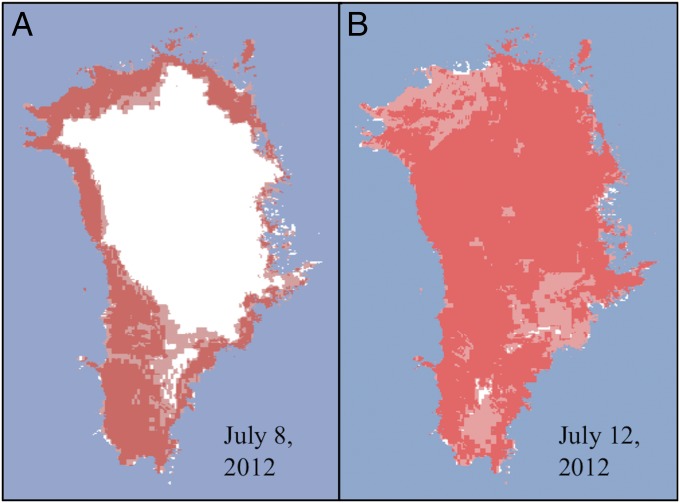
Fig. 1.
Melt extent over the GIS determined from Oceansat-2 satellite scatterometer, Special Sensor Microwave Imager/Sounder, and Moderate-resolution Imaging Spectroradiometer satellite data for (A) July 8, 2012, and (B) July 12, 2012. Red areas indicate melt detected by the satellites, white areas indicate no melt, and blue represents ocean. The surface of almost the entire ice sheet, including the dry snow region, experienced melt on July 12, 2012. Figure courtesy of Dorothy Hall, NASA Goddard Space Flight Center.

