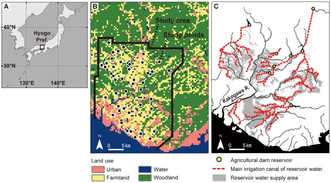
Figure 1. Description of study area.
A) Locations of Hyogo Prefecture, Japan, B) study area and ponds with land use, C) agricultural dam reservoirs, irrigation canals, and reservoirs' water supply area. Land use in (B) and irrigation canals in (C) are described respectively using Land utilization segmented mesh data with 100 m meshes (created in 2009; National Land Information Division, National and Regional Policy Bureau, Ministry of Land, Infrastructure, Transport and Tourism, Tokyo, Japan) and the 1/25,000 irrigation canal network maps (provided by Japanese Institute of Irrigation and Drainage, Tokyo, Japan).

