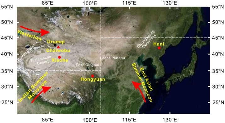
Figure 1. Sketched map showing the location of the Chaiwobu peatland (red solid triangle) and some of the related research sites (red solid circles).
The three boxed regions in the Chinese mainland and its adjacent areas define major summer precipitation areas: the westerly region (35–55°N, 50–105°E), the EASM region (22.5–45°N, 105–145°E), and the ISM region (5–35°N, 65–105°E). The base map was obtained from TIANDITU Co., LTD, China (GS, No.6034, 2013), and the related research marks were added using the CorelDRAW Graphics Suite 12.

