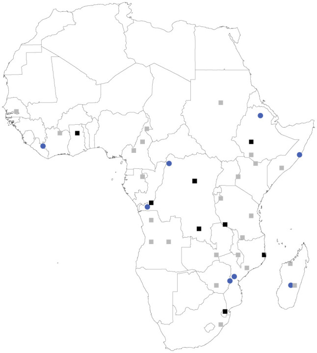
Figure 1. The set of sites that most efficiently captures the Vigna genus excluding the priority crop wild relatives (CWR) (squares), compared with the set of sites identified specifically to represent the priority CWR (blue circles).

The eight highest priority planning units from the Vigna genus set (identified in black) capture 10 of the 13 priority Vigna CWR. Eight priority CWR-specific planning units capture all 13 priority Vigna CWR taxa. Content for the maps was generated in Marxan 1.8.10 and the map images were generated in ArcGIS 1038.
