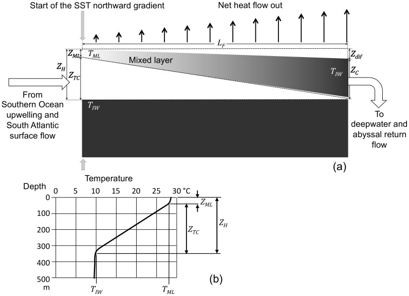
Figure 2. AMOC North Atlantic surface flow.
(a) Darker color represents higher density. The hot (south) end of the flow path is defined (imprecisely) as the latitude where the SST northward gradient starts. The height of seawater above the bottom of the thermocline point (ZH) is the combined depth of the mixed layer (ZML) and the thermocline (ZTC). The cold (north) end of the flow path is defined as the latitude where the mixed layer temperature becomes equal to the temperature at the bottom of the thermocline (TIW). At the cold end of the flow path the height of seawater (ZC) is defined as the vertical distance from the sea surface to the bottom of the thermocline at the hot end. The driving force for flow is the difference in sea surface heights between the two ends of the flow path (Zdif). The vertical arrows represent the net heat flow out from the ocean surface due to radiative cooling, increasing with increasing latitude. (b) Typical tropical Atlantic temperature-depth profile representing the south end of the AMOC flow path. The temperature of the mixed layer at that point is nearly uniform down to the upper inflection point (TML) and the temperature of the thermocline decreases linearly with depth down to the lower inflection point, marking the beginning of intermediate water (TIW).

