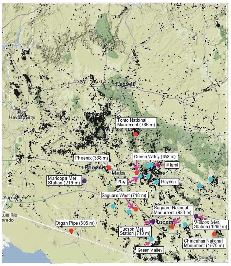
FIG 1.
Geographic location of southern Arizona IMPROVE stations (orange markers), with altitudes above sea level reported in parentheses. Locations of selected mines, prospects, quarries, and processing mills and plants (including abandoned mines) are shown as black dots (State of Arizona Department of Mines and Mineral Resources, http://mi nes.az.gov/Publications/AzmilsMap.pdf); the emissions strength of metals and metalloids from these sites is uncertain. Also shown are the location of major active copper mining and smelting operations (blue markers) (http://www.admmr.state.az. us/), and meteorological stations close to the IMPROVE sites (purple markers).

