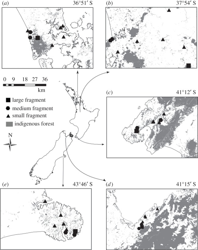
Figure 1.
Field site localities. Five sites span the distribution of M. excelsum (national map modified from Gardner [43]) and extend across a latitudinal gradient of approximately 7° over the North and South Island of New Zealand: Auckland (a), Waikato (b), Wellington (c), Nelson (d) and Banks Peninsula (e). Grey shading in panels (a–e) shows the distribution of indigenous forest in the five study localities. At each locality, eight forest fragments (average latitude given above insets) were sampled, with the fragments categorized according to area: large more than 100 ha (squares), medium 10–100 ha (hexagons) and small less than 10 ha (triangles).

