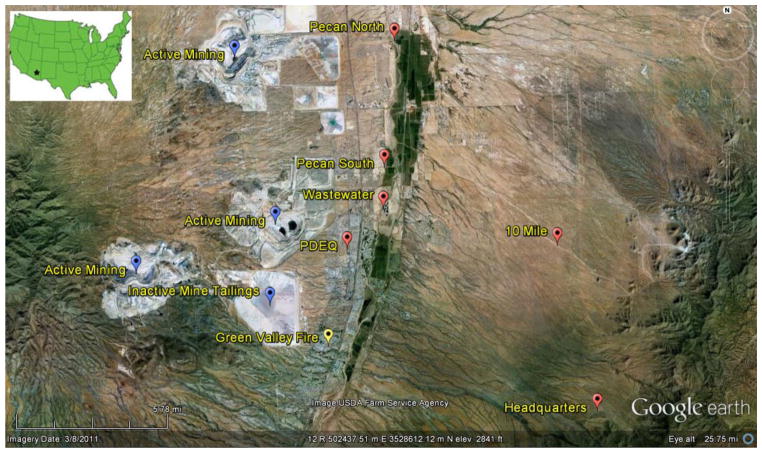
Figure 1.
Field locations for dust monitoring in Green Valley, AZ, USA. Pecan North and Pecan South are located on the edge of a pecan tree grove and beside a dry river bed; Wastewater is located beside the same river bed; PDEQ represents an urban sample; 10 Mile is approximately 10 miles (16 km) from mining activities; HQ (Santa Rita Experimental Range) represents a natural background site chosen for the region. Annual data were taken from Green Valley Fire. Mining activities for the region are labeled in blue.

