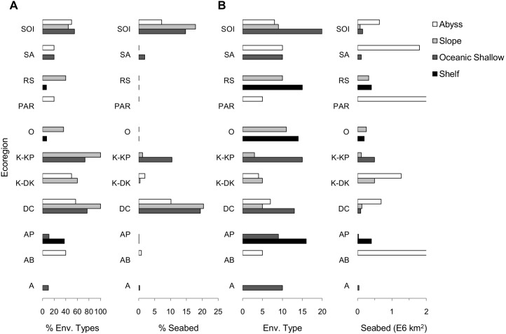
Figure 4. Marine protected areas and their spatial coverage of ecoregions and representation of environmental types.
A) The proportion of the seafloor and the proportion of environmental types included either partly or wholly within existing MPAs are displayed within four broad geomorphic classes. These classes are further described in Table 3 and are represented within the plots from top to bottom as Abyss (white), Slope (light grey), Oceanic Shallow (dark grey) and Continental Shelf (black). B) The total number of environmental types and seafloor area for each geomorphic class are also shown. The incomplete bars within PAR and AB have values of 2.95 E6 km2 and 6.59 E6 km2 respectively. The ecoregion code names are: SOI (South Orkneys Islands), SA (South Atlantic), RS (Ross Sea), PAR (Pacific-Antarctic Ridge), O (Oates), K-KP (Kerguelen-Kerguelen Plateau Subregion), K-DK (Kerguelen-Deep Kerguelen Subregion), DC (Del Cano), AP (Antarctic Peninsula), AB (Atlantic Basin), A (Amundsen).

