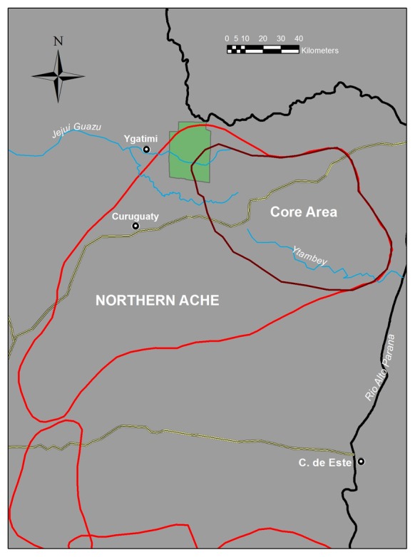
Figure 1. Northern Ache maximal boundaries and core use area during the second half of the 20th century.

Bands were distributed throughout the core area, occassionally visiting more remote tribal home range in the Southwest. Band location moved almost daily with no restricted localities. The construction of the road passing through Curuguaty and the core Ache territualory was the impetus for permanent peaceful outside contact in the 1970s. The green square shows the modern day Mbarcayu reserve.
