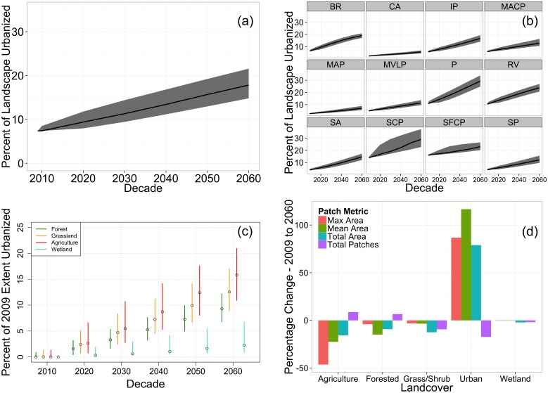
Figure 3. Land cover change metrics.
(a) and (b) show time series of projected urbanization for 200 model simulations for the study region and twelve ecoregions, respectively. (c) The 95% projected range of the proportion of each land cover type converted to urban. (d) Change in patch metrics for all land cover types between 2009 and 2060. Ecoregion abbreviations in (b) are as follows: BR – Blue Ridge, CA – Central Appalachians, IP – Interior Plateau, MACP – Mid Atlantic Coastal Plain, MAP – Mississippi Alluvial Plain, MVLP – Miss. Valley Loess Plains, P – Piedmont, RV – Ridge and Valley, SP – Southeastern Plains, SCP – Southern Coastal Plains, SFC – South Florida Coastal Plain, SA – Southwest Appalachian.

