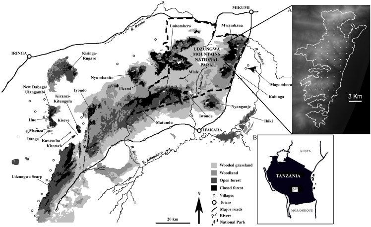
Figure 1. Map of the study area, the Udzungwa Mountains of south-central Tanzania.
The map shows the main habitat types and blocks with closed-canopy forest (adapted from [53]). The study forest was Mwanihana in the northeastern portion of the range, which is zoomed in inset (A) where the 60 camera trap sites are shown as white dots and the background is a Digital Elevation Model (dark is lower elevation); (B) shows the position of Udzungwa in Tanzania.

