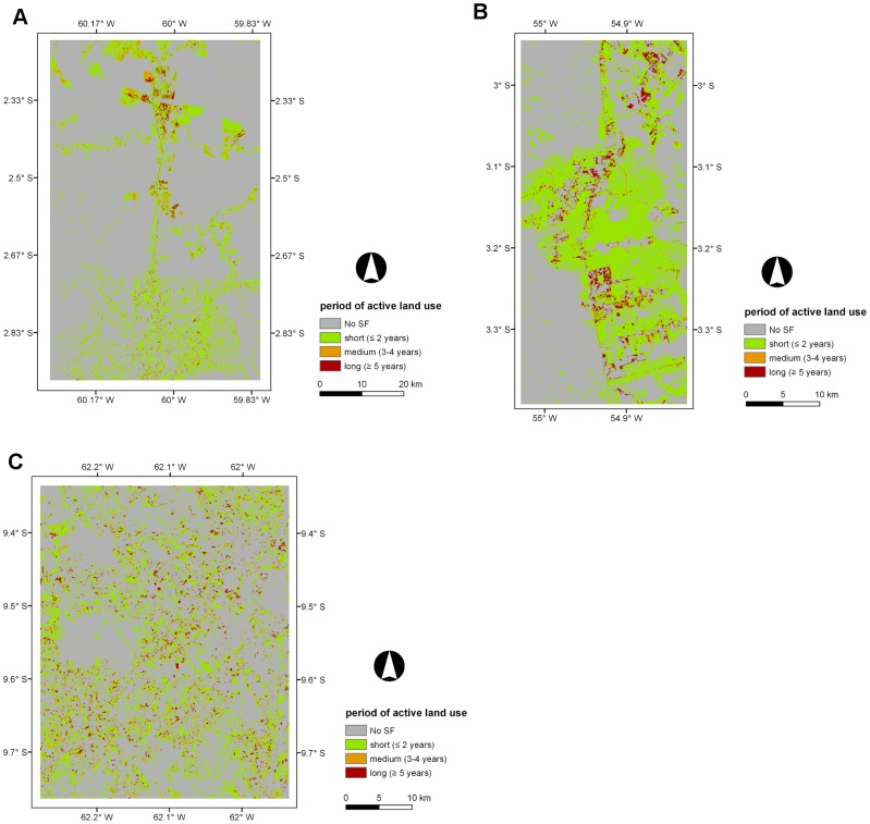
Figure 4. Maps displaying the period of active land use (PALU, years) across the three selected sites.
Maps displaying the period of active land use (PALU, years) across the three selected sites for areas undergoing secondary forest (SF) in the last year of the corresponding time-series; A) Manaus (2011), B) Santarém (2010), and C) Machadinho d’Oeste (2011). An area of 667 ha (1.5%) with a PALU of zero in the Santarém site was included in the short PALU class (≤2 years) and corresponds to areas that were SF from 1984 to 2010.

