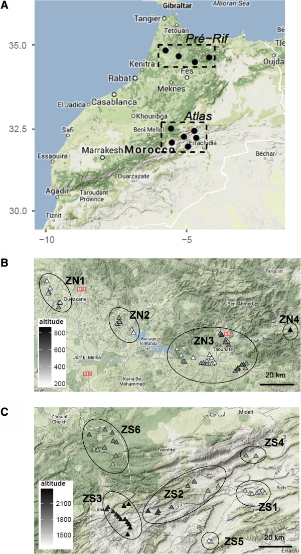
Figure 1.

Study areas. Map of Northern Morocco showing the locations of the two study regions (A). Details of each region showing the zones and the surveyed villages (B. Pre-Rif, C. Atlas Mountains). Symbols are colored in accordance with the villages’ altitude. The map backgrounds have been extracted from Google Map.
