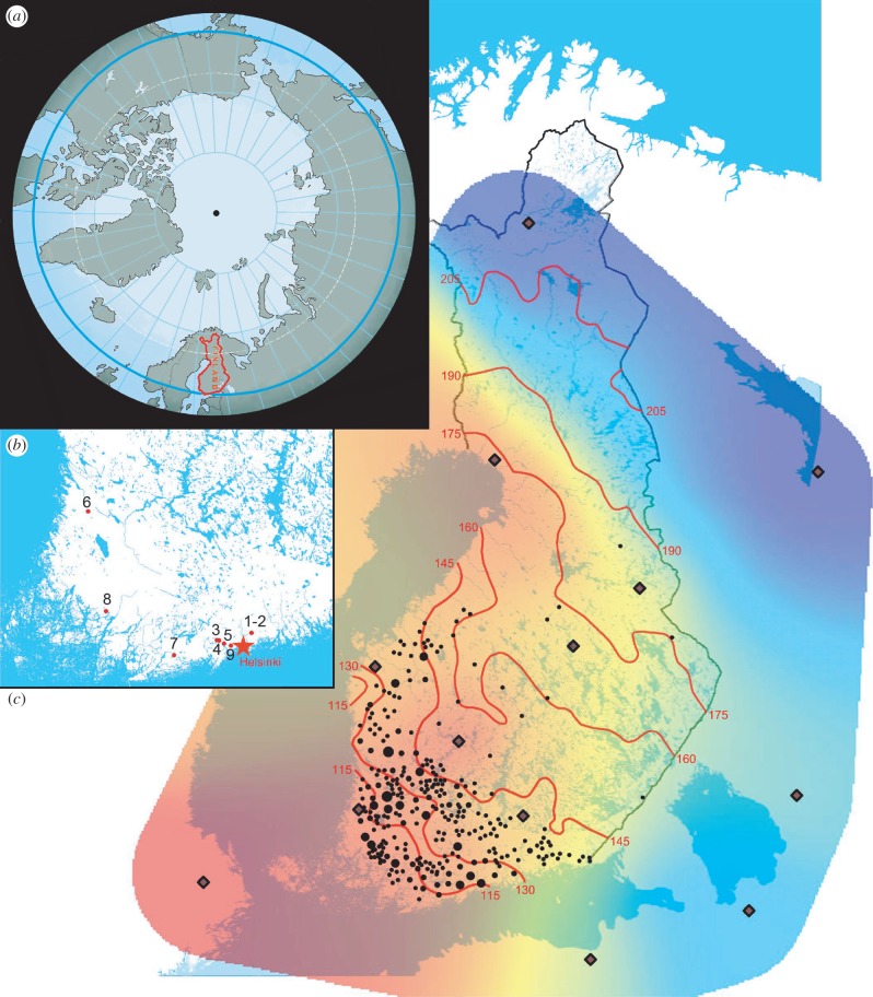
Figure 1.
Integrated maps of: (a) the northern hemisphere relative to the North Pole. Highlighted are the modern borders of Finland (in red) and the 60th parallel north (in light blue), (b) the location of all Finnish prehistoric sites from which sherds were sampled (numbers correspond to table 1), and (c) the distribution of the Corded Ware culture within Finland. Mapped (black dots) are finds of typical stone battle axes, used as a proxy (data from [8]). The red isolines indicate average permanent snow cover period from 1981 to 2010 (data from [9]). A recent study estimates the snow cover period ca 4500 years ago would have been 40–50 days less than today [10]. Overlying coloration refers to the lactose persistance (LP) allele gradient in modern northeastern Europe (see the electronic supplementary material, appendix B: Material and methods and table 1, for details); lozenge dots specify the dataset mean points for the triangulation.

