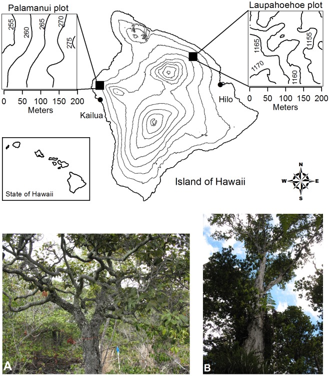
Figure 1. Contour map of the two 4-ha forest plots on Hawai‘i Island.
Pālamanui site in west Hawai‘i is lowland dry forest (LDF; left panel showing the dominant canopy tree Diospyros sandwicensis and the open canopy and understory structure of small trees and shrubs); Laupāhoehoe plot in east Hawai‘i is montane wet forest (MWF; right panel showing Metrosideros polymorpha tree and Cibotium spp. tree fern understory).

