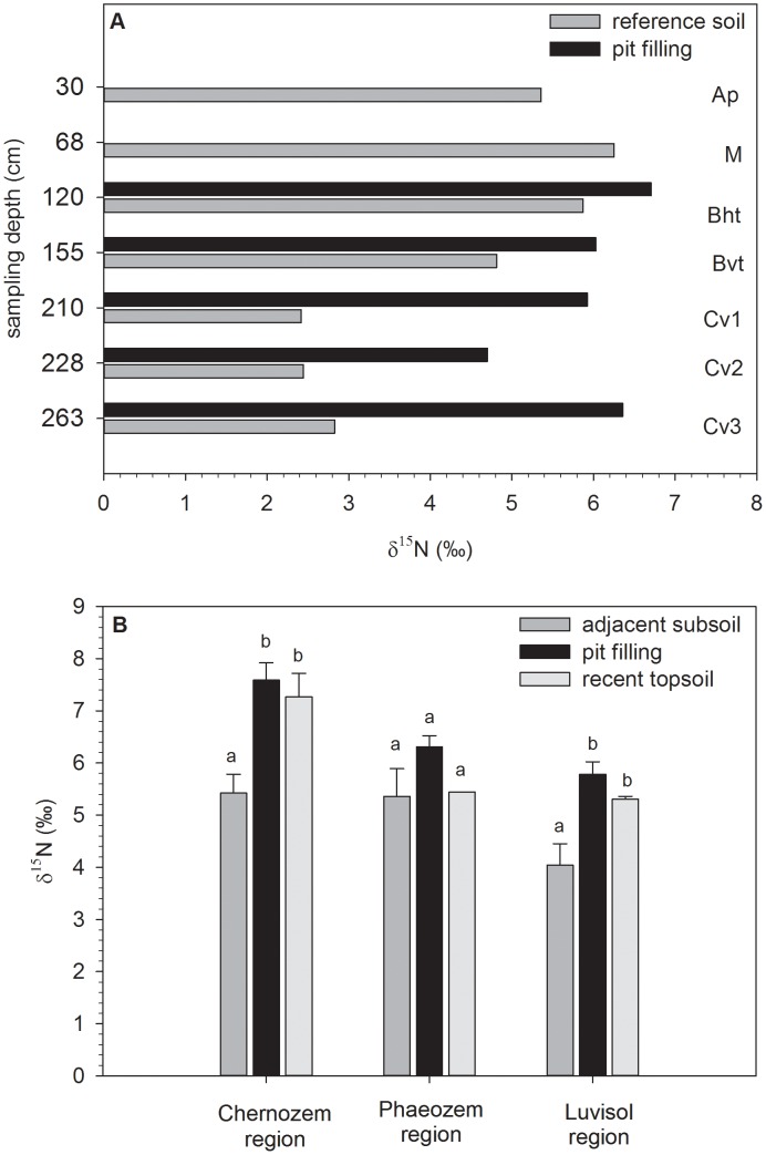
Figure 1. Depth distribution of δ15N (in ‰) at the excavation site Merzenich in the Luvisol region in the reference soil outside the pit, and in the pit filling (A).
Soil horizon designation of reference soil follows the German soil classification [132]. Ap = ploughed humic horizon, M = colluvial deposit, Bht = humic, argic horizon, Bvt cambic, argic horizon, Cv = parent loess, slightly weathered. And δ15N values (in ‰) in the adjacent subsoil, the pit filling representing the prehistoric topsoil, and recent topsoil in the Chernozem, Phaeozem, and Luvisol region (B). The error bars represent the standard error. Within one region, different letters designate significant (p<0.05) differences between sample sets.

