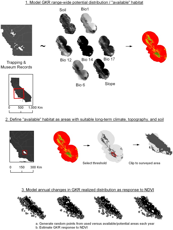
Figure 1. Flow chart of multi-step modeling approach.
Here we present a multi-method, multi-scale approach to estimating species distributions. In the first step, Maxent is used to relate contemporary trapping and historical museum records with static environmental variables. The result is a model of potential distribution at a range-wide scale. Predictor variables included soil particle size (“Soil”), annual mean temperature (“Bio1”), minimum temperature of coldest month (“Bio 6”), annual precipitation (“Bio 12”), precipitation of driest month (“Bio 14”), precipitation of driest quarter (“Bio 17”), and slope. We then selected a threshold to define all available habitat for GKR, with the 99% Maxent value for training data used as the threshold. Finally, within the potential habitat in the Carrizo Plain National Monument, we examined annual changes in population extent based on aerial surveys and driven by measures of resource availability (NDVI).

