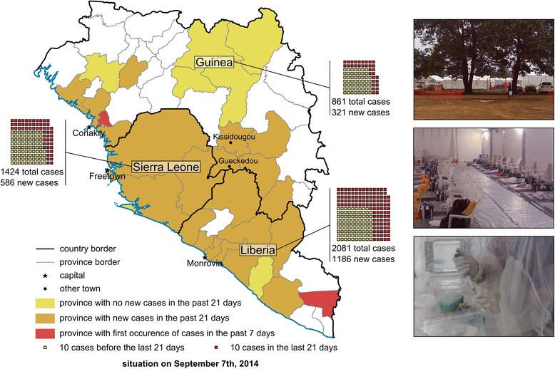
Figure 1.

Map of the West African ebolavirus outbreak as of 7 September 2014. Country and province borders according to the CIA World Factbook are indicated as black or grey lines, respectively. Provinces with no new cases in the 21 days prior to 7th September 2014 (according to the WHO situation report from 12th September 2014) are highlighted in yellow, provinces with new cases in the 21 days prior to 7th September in orange, and provinces showing cases for the first time in the 7 days prior to 7th September are highlighted in red. Case numbers for each country are indicated, with each square representing 10 cases. Only countries with extensive person to person transmission are shown; Senegal and Nigeria are not shown. Inserts show a typical treatment and isolation facility set up as part of the international response to the outbreak, with the top insert showing the ELWA III treatment and isolation site, the middle insert showing the inside of a treatment tent, and the bottom insert showing a lab worker inactivating patient samples in a portable isolation chamber (pictures courtesy of Barry Fields (CDC Nairobi) and Dave Safronetz (NIH)).
