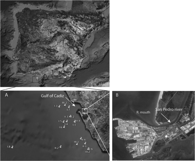
FIG 1.
Sampling locations in the Gulf of Cadiz. (A) Oceanographic campaigns were performed during November 2010 (campaign I, at locations I.1 [36.4250N, 6.3510W], I.2 [36.4750N, 6.3990W], I.3 [36.5640N, 6.5230W], I.4 [36.4310N, 6.4400W], I.5 [36.4270N, 6.4760W], I.6 [36.3800N, 6.4710W], I.7 [36.5600N, 6.4160W], I.8 [36.1960N, 6.0400W], and I.9 [36.1820N, 6.2000W]), March 2011 (campaign II, at locations II.1 [36.2320N, 6.2380W], II.2 [36.2020N, 6.5090W], II.3 [36.4750N, 6.4030W], and II.4 [36.2760N, 6.2850W]), and October-November 2011 (campaign III, at locations III.1 [36.2260N, 6.3280W], III.2 [36.1820N, 6.2000W], III.3 [36.5780N, 6.4600W], and III.4 [36.4250N, 6.3510W]). (B) Samplings at the mouth of the San Pedro River were carried out during October 2010 and May 2011. Template map source, Google Earth.

