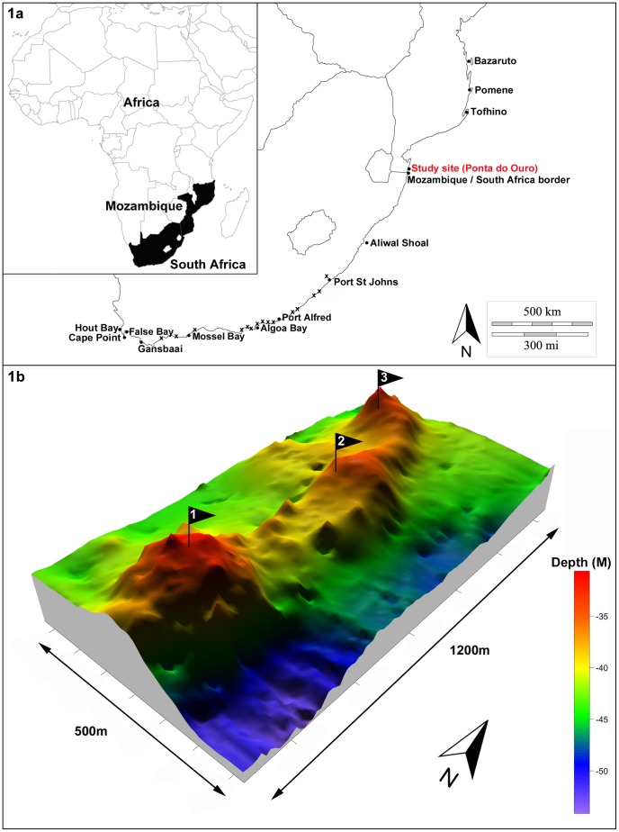
Figure 1. Study site Map and Pinnacle reef bathymetry.
Figure 1a shows a map of southern Africa with the location of the study site at Ponta do Ouro in southern Mozambique. All other named locations represent acoustic receiver sites on the coast (represented by a circle) or within an estuary (represented by an x) from which additional bull shark detection data was obtained. Figure 1b shows the bathymetry of the Pinnacle reef complex with the colour scale indicating the corresponding depth of the reef showing the shallow spine surrounded by reef drop offs. Numbered flags represent the approximate location of three acoustic receivers on the reef.

