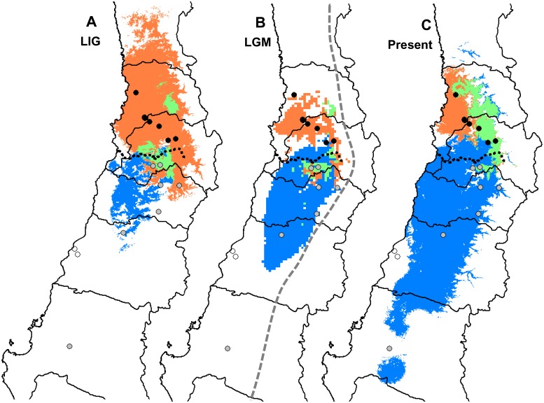
Figure 5. Environmental Niche Modelling (ENM) of Dioscorea humilis estimated under Last Interglacial (LIG) (A), Last Glacial Maximum (LGM) (B) and current (C) climate conditions.
In orange, northern D. humilis subsp. humilis genetic group, in blue, southern genetic group and in bright green, overlapping areas among predicted distributions. A tenth percentile threshold was applied. Black circles: northern populations of D. humilis subsp. humilis (Dhh01 to Dhh08); grey circles: southern populations of D. humilis subsp. humilis (Dhh09 to Dhh15). The black dashed line indicates the location of the Maipo river. The grey dashed line in B indicates the approximate extent of the ice sheet during the LGM after [5]. Map contours constructed from spatial data retrieved from http://www.diva-gis.org/gdata.

