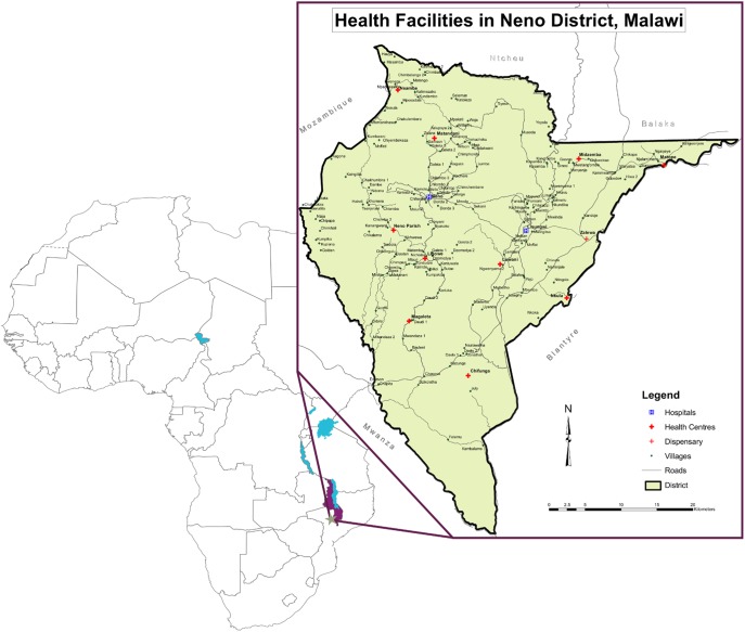
Figure 1. Map of Neno District, Republic of Malawi.
The inset picture depicts Neno district, located in the southwestern portion of the country. The district shares an international border with Mozambique to the west and borders with Ntcheu district to the north; Balaka and Zomba districts to the northeast; Blantyre district to the east; Chikwawa to the south; and Mwanza district to the southwest. The inset legend illustrates the locations of major health facilities, including the district’s two hospitals–Neno District Hospital and Lisungwi Community Hospital–as well as the remaining 11 health centers.

