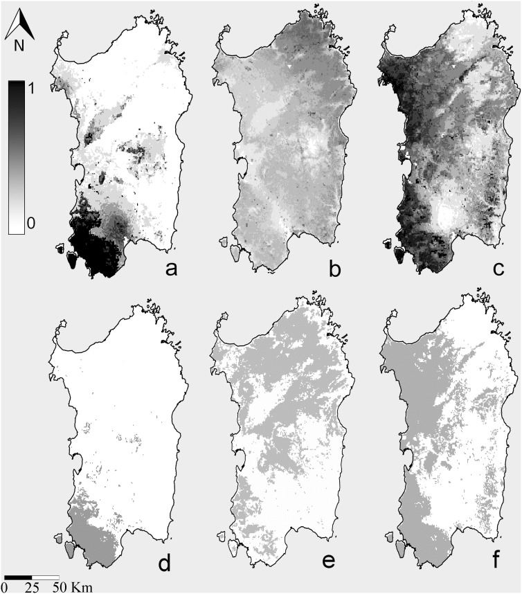
Figure 3. Maxent Species Distribution Models (SDM).
a: SDM for R. euryale on Sardinia calibrated with Sardinian records only; b: SDM for Rhinolophus euryale on Sardinia calibrated with presence records from Italian populations except that of Sardinia and projected to the island; c: SDM for R. mehelyi on Sardinia calibrated with Sardinian records only; c: binary map for R. euryale on Sardinia calibrated with Sardinian records only; d: binary map for Rhinolophus euryale on Sardinia calibrated with presence records from Italian populations except that of Sardinia and projected to the island; e: binary map for R. mehelyi on Sardinia calibrated with Sardinian records only The publicly available map layer was obtained from www.fao.org/geonetwork/srv/en/main.home and the image prepared with the Quantum Gis 2.2.0 Valmiera and Maxent open source software packages.

