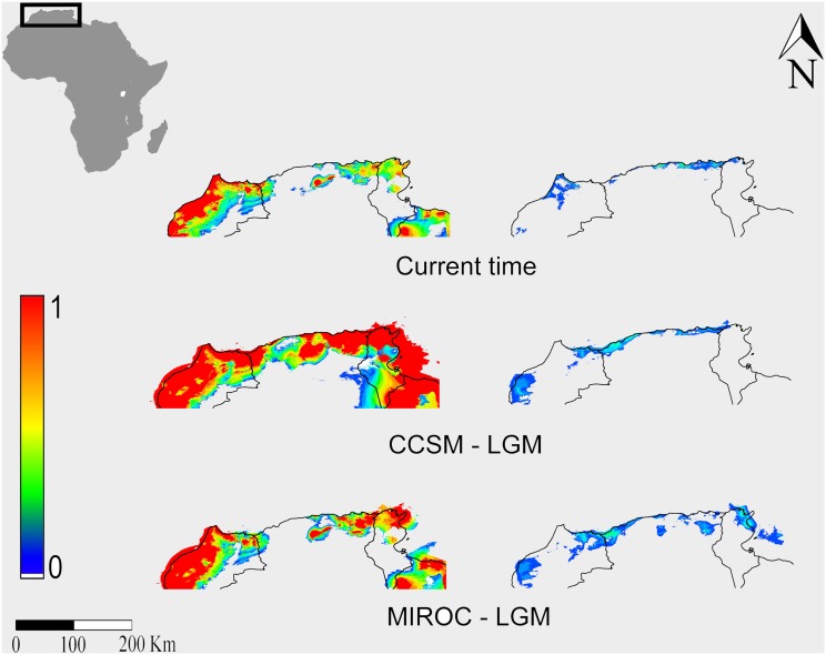
Figure 5. Maxent SDMs for Rhinolophus euryale calibrated respectively on presence records of bats from Sardinia (left) and from the remaining Italian areas (right) and projected to northern Africa.
LGM = Last Glacial Maximum. CCSM = Community Climate System Model; MIROC = Model for Interdisciplinary Research on Climate. The publicly available map layer was obtained from www.fao.org/geonetwork/srv/en/main.home and the image prepared with the Quantum Gis 2.2.0 Valmiera and Maxent open source software packages.

