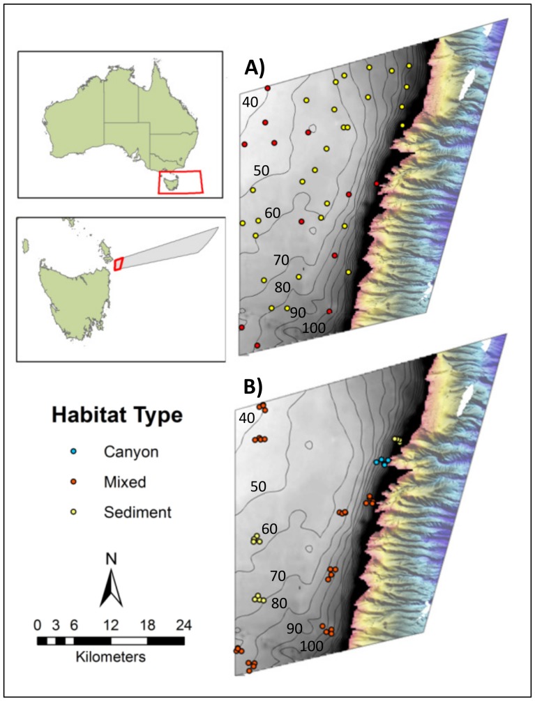
Figure 1. Location of the Flinders Commonwealth Marine Reserve (CMR) in Tasmania, Australia.
Panels A and B show the CMR's Multiple Use Zone (IUCN VI) where survey work was conducted. The grey zone is the continental shelf (less than 200 m depth) where there was little pre-existing mapping data. Coarse bathymetry data (gridded at 250 m horizontal resolution) sourced from Geoscience Australia is shown with 10 m contour intervals overlain. The coloured area to the right shows the relatively steep and highly incised upper continental slope that had been mapped previously with multibeam sonar extending from 200 to 1500 m. A) Location of the 40 sites surveyed for habitat type in phase one of the sampling program. B) Location of the clustered sites where Baited Remote Underwater Videos (BRUVs) were deployed in phase two. Sites are coloured according to the broad habitat type: sediment (yellow); mixed, low-profile reef and sediments (red); canyon head (blue) recorded during phase one of sampling.

