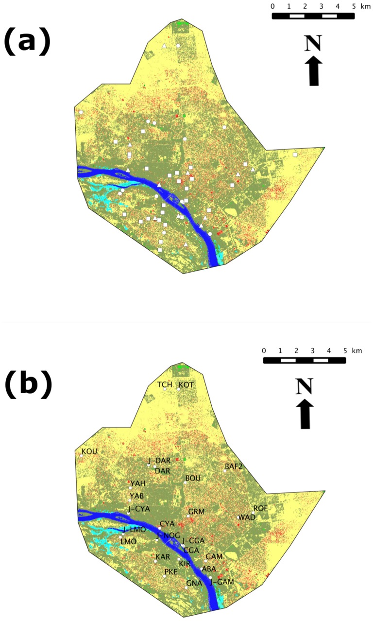
Figure 1. All trapping investigated localities within the city of Niamey (a): circles, squares and triangles indicate sites investigated through SP, OP and SP+OP protocols, respectively.
Mapping of SP localities only, with their acronyms referring to Table 1 (b). On both maps, colors of the background correspond to GIS-based categories of landscape elements: yellow for non-covered soil; red for buildings; dark and light green for trees and diverse vegetation, respectively; dark and light blue for Niger River and other water surfaces, respectively.

