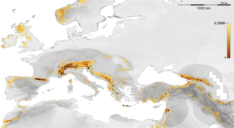
Figure 2.

Distribution model for P. macrobullaris, presented on a greyscale elevation map. Only suitable areas (SV >0.2886) are shown in a colour gradient from light yellow (low suitability) to brown (high suitability). Presence location records used for modelling are represented by black dots and the darkened region is the area used for calibrating the model.
