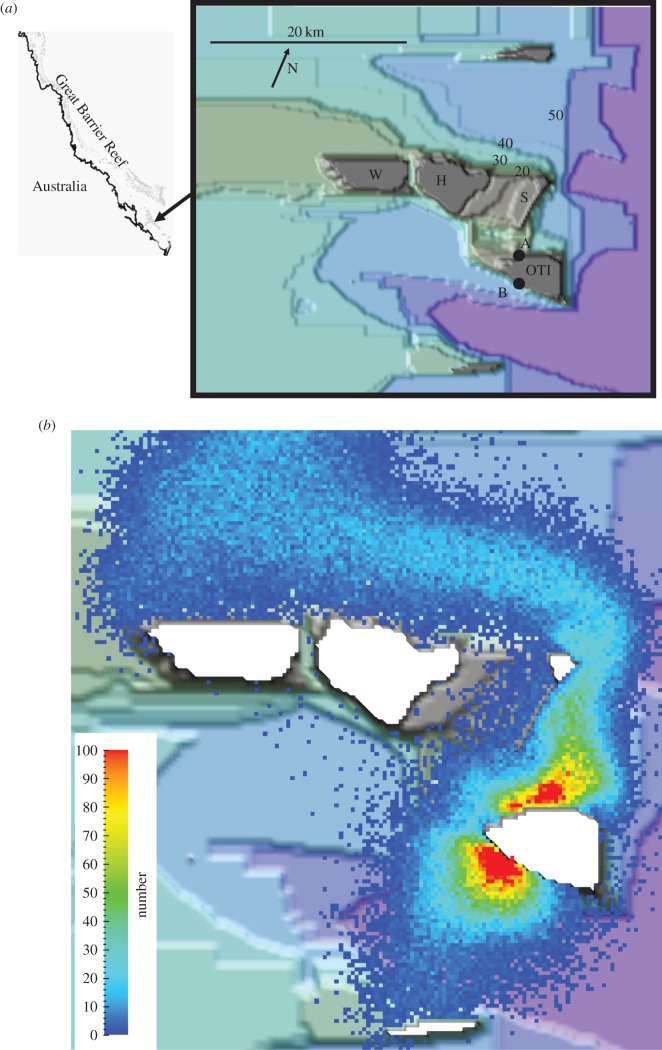
Figure 1.
(a) A general location map and a bathymetric map (depth in metres) of the hydrodynamic modelling area. The reefs are Wistari (W), Sykes (S), Heron (H) and One Tree Island (OTI). A and B are the model spawning sites at OTI. (b) The predicted tidally averaged smell plume from OTI. The scale bar is in number of smell tracers per cell (200 × 200 m).

